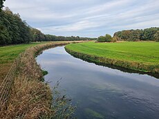
Category:Böhme (Aller)
Jump to navigation
Jump to search
river in Germany | |||||
| Upload media | |||||
| Instance of | |||||
|---|---|---|---|---|---|
| Location |
| ||||
| Length |
| ||||
| Elevation above sea level |
| ||||
| Origin of the watercourse | |||||
| Mouth of the watercourse | |||||
| Drainage basin |
| ||||
| Tributary |
| ||||
 | |||||
Subcategories
This category has the following 4 subcategories, out of 4 total.
B
- Böhme (Aller) in Walsrode (2 F)
T
Media in category "Böhme (Aller)"
The following 40 files are in this category, out of 40 total.
-
2020-05-21 Boehmebruecke Bad Fallingbostel.jpeg 1,974 × 2,961; 2.52 MB
-
Bad Fallingbostel Treppenspeicher an Böhme.jpg 3,351 × 2,513; 2.09 MB
-
Bahnbruecke Boehme 10-04-15.jpg 1,023 × 686; 333 KB
-
Boehme-Tal Lieth.jpg 1,024 × 768; 252 KB
-
Boehme01.jpg 520 × 342; 58 KB
-
Bomlitz Boehme 2014-03-29.jpg 2,501 × 1,850; 2.05 MB
-
Böhme (Aller) bei Mengenbostel.jpg 2,000 × 1,500; 888 KB
-
Böhme bei Bomlitz-Elferdingen.JPG 2,560 × 1,920; 2.03 MB
-
Böhme bei Hollige.jpg 2,000 × 1,500; 575 KB
-
Böhme Map.png 796 × 1,047; 1.05 MB
-
Böhme Sohlgleite Bad Fallingbostel 2021.jpg 4,032 × 3,024; 5.17 MB
-
Böhme.png 569 × 500; 595 KB
-
Böhmequelle Pietzmoor.JPG 3,625 × 2,705; 5.37 MB
-
Cannel view.jpg 1,600 × 757; 680 KB
-
Confluence of rivers Boehme and Warnau (right).jpg 3,072 × 2,304; 4.77 MB
-
Die Böhme am Rittergut Böhme in Böhme IMG 6338.jpg 4,500 × 3,000; 6.47 MB
-
Die Böhme am Rittergut Böhme in Böhme IMG 6339.jpg 4,500 × 3,000; 6.12 MB
-
Die Böhme am Rittergut Böhme in Böhme IMG 6341.jpg 4,504 × 3,000; 6.25 MB
-
Die Böhme am Rittergut Böhme in Böhme IMG 6352.jpg 4,501 × 3,000; 6.53 MB
-
Die Böhme am Rittergut Böhme in Böhme IMG 6356.jpg 4,500 × 3,000; 6.51 MB
-
Die Böhme am Rittergut Böhme in Böhme IMG 6357.jpg 4,500 × 3,000; 4.04 MB
-
Die Böhme am Rittergut Böhme in Böhme IMG 6358.jpg 4,499 × 3,000; 6.1 MB
-
Die Böhme am Rittergut Böhme in Böhme IMG 6359.jpg 4,493 × 2,996; 6.8 MB
-
Die Böhme am Rittergut Böhme in Böhme IMG 6360.jpg 4,504 × 3,000; 4.47 MB
-
Forest area view.jpg 1,600 × 758; 810 KB
-
Fuhrhop - Böhmebrücke.jpg 1,920 × 1,080; 2.2 MB
-
Gedenkstein Völkerschlacht 1813 (Bad Fallingbostel) 01.jpg 4,032 × 3,024; 4.79 MB
-
Huenenburg with river Boehme.jpg 3,072 × 2,304; 4.57 MB
-
Infotafel Böhme als Grenze (Bad Fallingbostel).jpg 2,840 × 3,786; 1.28 MB
-
Lieth Boehmetal 2016-03-27.JPG 2,498 × 1,836; 3.34 MB
-
Linde Fallingbostel Böhmetal.jpg 414 × 588; 43 KB
-
NSG Böhmetal bei Huckenrieth.jpg 1,600 × 900; 661 KB
-
Paul Müller-Kaempff - Landschaft bei Fallingbostel.jpg 700 × 454; 81 KB
-
River Boehme from Huenenburg.jpg 3,072 × 2,304; 4.49 MB
-
Sandfang Böhme bei Soltau 01.jpg 4,000 × 3,000; 5.09 MB
-
Sandfang Böhme bei Soltau 02.jpg 4,000 × 3,000; 3.45 MB
-
Vierde - Böhmeschlucht.jpg 3,543 × 2,657; 7.7 MB
-
Walsrode - Böhme 01.jpg 6,000 × 4,000; 18.11 MB
-
Walsrode - Tietlinger Wacholderhain - Böhme 01 ies.jpg 3,888 × 2,592; 3.03 MB
-
Wense (Osterheide)@Mühlenteich.JPG 4,608 × 3,456; 7.27 MB


